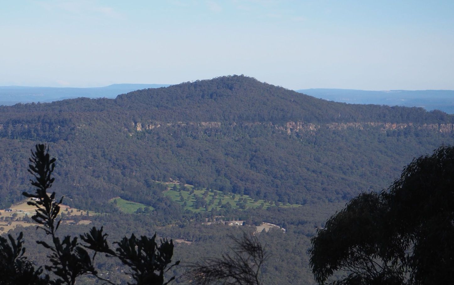
Map
Full List
.csv file

Mount Skanzi

NameElevation (metres)Prominence (metres)Points
Mount Bindo
1362
433
7
Bonfire Hill
1296
226
7
Mount Tarana
1275
282
7
Mount Coricudgy
1258
588
7
Mount Coriaday *
1231
321
9
Mount Walker
1187
241
8
Dulabree *
1183
151
4
Mount Wilworril *
1179
306
9
Mount Cloudmaker
1163
389
8
Tayan Pic
1156
370
10
Marrangaroo
1148
161
4
Mount Durambang
1145
359
8
Mount Never Never *
1143
266
8
Mount Midderula *
1142
217
8
Mount Monundilla *
1119
384
8
Mount Kelgoola *
1116
226
8
Evans Crown
1103
177
5
Mount Pomany *
1100
348
8
Bin Ben
1095
285
9
Mount Stromlo *
1088
155
4
Mount Darcy
1082
227
6
Kekeelbon Mountains
1080
186
6
Mount Cox *
1074
183
6
Mount Coorongooba
1072
206
7
Baldy Peak *
1070
308
6
Black Ridge
1064
184
4
Jews Mountain *
1061
183
4
Mount Banks
1059
196
6
Wheelbarrow Mountain *
1054
316
7
Mount Colong *
1045
243
7
Genowlan
1038
294
6
Mount Airly
1036
245
5
Fitzgerald Mount *
1033
183
7
McDonalds Mountain
1032
191
6
Church Mountain
1024
158
4
Mount Tomah
1020
175
3
Mount Marsden
1019
261
7
Brymair *
1019
191
6
Pantoneys Crown *
1017
324
8
*
1016
175
6
Blackmans Crown
1012
189
5
Mount Touwouwan
1010
234
7
Wongalee *
996
209
6
Donkey Mountain *
993
334
8
Above Newnes *
987
191
5
Haystack Mountain *
986
229
7
Bluff Mountain *
980
158
3
Teatree *
971
206
4
Mount Towinhingy
965
178
6
Mount Warrigal
964
294
6
Beer Bung *
964
170
3
Mount Solitary
959
311
6
Dairy Mountain *
952
168
5
Razorback *
951
168
5
Spring Log Ridge
947
190
5
Mount Coolcalwin *
945
229
7
Pipeline
937
187
4
Baker Ridge *
914
183
4
Mount Bathurst *
905
150
2
Coxs Crown *
890
157
5
Donkey Junior *
881
207
6
Yerranderie Peak *
872
191
6
Mount Brace *
871
195
6
Tonalli Mountain *
870
201
4
Mini Mini Range
869
167
3
Cottage Rock *
866
186
3
Mount Remorseless *
865
260
5
Tebradden *
857
174
3
Mootick Plateau *
848
151
1
Gunyawarilda *
845
215
4
Gundangaroo *
844
381
6
Elyl Peak *
841
176
2
Lords Mountain *
839
202
4
The Sentinels *
839
158
4
New Yards Hill *
839
158
1
Mount Jellore
835
190
6
Carlyon *
821
175
2
North of Glen Davis *
815
199
3
Green Hill *
813
163
1
Ironpot Ridge
804
206
4
Bull Island Peak *
804
200
6
Mount Alexandra
794
162
3
Perry *
772
153
1
Wollemi *
767
181
1
Broken Rock Mountain *
762
331
4
Green Wattle Mountain *
744
266
5
Torbanite Mountain *
729
233
5
Mount Milo *
727
155
3
Martindale
695
286
4
Flat Top Mountain
687
165
3
Mount Carrialoo
686
215
4
Mount Yengo *
667
365
6
Mount Neilson
661
321
6
Mount Warrawolong
639
403
7
Mount Skanzi
622
271
5
Popes Creek *
613
211
5
Mount Moollattoo
605
186
4
Mount Wareng
594
265
6
Broughton Head *
578
196
3
Mount Cookem *
573
239
3
Mount Poppong
573
212
4
Doyles Range *
569
156
0
Mount Isobel
553
207
3
Island
544
193
5
Culoul Creek
541
188
1
Mount Kembla
534
209
5
Mellong
518
192
1
Bridgeview Farm *
503
205
2
Parr South
502
159
3

Elevation622 metres
Prominence271 metres
Location-34.7675, 150.4367
RegionSouth
Points5

Download GPX file

A big mountain that dominates Kangaroo Valley. The slopes and summit are covered in rainforest. The top has great views.

Mount Skanzi is on private land. Ensure you have required permissions before climbing this mountain.

Driving directions

From Kangaroo Valley, drive west along Mount Skanzi road. At the Y intersection, veer right onto Tallowa Dam Road. You will see Mount Skanzi looming overhead to your left. Follow this road another 6.5km until a dirt driveway appears to your left. Park on the side of the road.

Directions to the summit

1. From the road, follow the dirt road straight up the hill.

2. After about 600m, a driveway branches off to the left and the road curves around to the right. Start climbing up the spur between the two roads.

3. After about 250m cycads appear and the climb becomes very steep. Keep going straight up! Loose stones underfoot make progress difficult.

4. At the top of the climb, you enter a beautiful dark rainforest and start heading east along a narrow ridge. A trick is to walk slightly below the top of the ridge, where the vegetation is usually a lot thinner.

5. You reach a fence and then there is a fire trail you can follow.

6. Take the right hand fork. Follow for another hundred meters or so, then head north off the trail and up the hill. Turn right once you reach the summit ridge.

7. There is a trig point at the summit, wiith some great views in various directions.